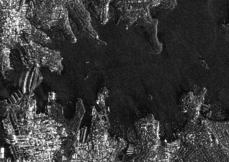
Guildford-based Surrey Satellite Technology Ltd (SSTL) has released the first images from the British designed NovaSAR-1 radar satellite which has cloud penetration capabilities.
The satellite launched last September and is tasked with detecting oil spills in the oceans and surveying the effects of deforestation. It will also be used to monitor shipping activity, alerting the authorities to any suspicious activity.
Science Minister Sam Gyimah said today: This ‘eye in the sky’ can capture an image a dozen times wider than the Strait of Dover and the data it provides can help crack problems from illegal shipping to alerting us to damaging pollution that needs to be countered.”
The UK government invested £21 million into NovaSAR-1’s construction.

SSTL Satellite
The NovaSAR-1 satellite was designed and manufactured in the UK by SSTL. Its payload the S-Band SAR was developed in Portsmouth by Airbus Defence and Space.
The Synthetic Aperture Radar (SAR) is a scientific radar device that sends out successive pulses of radio waves that are bounced off the earth’s surface back to the satellite’s antenna. As the satellite moves in orbit, it continues to send out pulses and collects their echos using a single beam forming antenna. The recorded pulse echos are combined to create a high resolution image.
In maritime mode the satellite can cover an area 400km wide across the surface of the oceans. While doing so it can spot ship positions, it then compares their location to ship tracking data. If a discrepancy is found in the comparison, that is a high indication of illegal activity.

Andrew Cawthorne Director of Earth Observation at SSTL comment in released statement that: “The quality of the SAR images we are downloading validate the capabilities of NovaSAR’s innovative low cost S-Band SAR platform and demonstrate successful delivery of valuable data for maritime, agricultural, forestry, ice-monitoring and disaster monitoring applications.”


