The final satellite of the MetOp series of meteorological satellites will be launched by the European Space Agency tomorrow from its launch station in Kourou, French Guiana.
The MetOp series provide remote sensing capabilities to both meteorologists and climatologists and help predict weather patterns with improved speed and accuracy.
Satellite Metop-C was originally due to replace its predecessors launched in 2006 and 2012, however the first two satellites are still functional and rather than replace each other, they will now work together in orbit.
EUMETSAT Director-General Alain Ratier commented in a released statement that: “MetOp satellites are technologically advanced and their instruments are still state-of-the-art.”
“We are in the fortunate and unexpected position soon having three MetOp’s in orbit at the same time, because MetOp-A, which was launched in 2006, has exceeded its five-year design life time by far and will remain in orbit until 2022.”
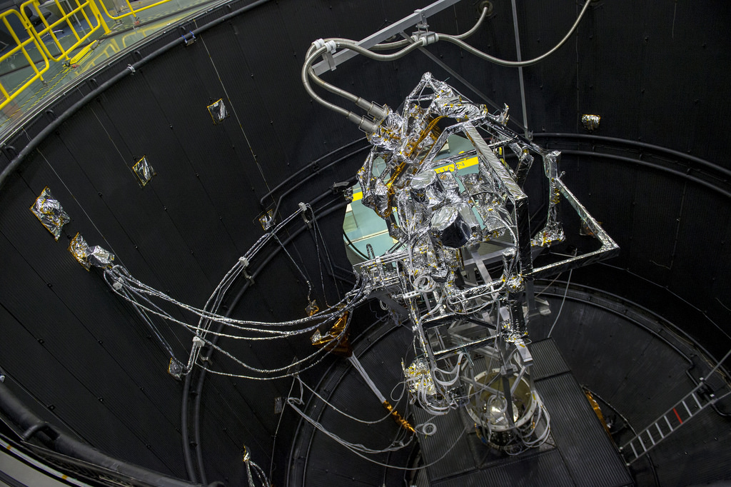
MetOp Satellite
The three MetOp satellites orbit the planets poles and form the Eumetsat Polar System (EPS).
Data gathered by EPS feeds directly into numerical weather prediction, enabling meteorologists to compute forecasts from just a few hours to forecasts ten days ahead. Microwave radiometers and sounders on the spacecraft measure global atmospheric temperature and the humidity structure.
On board is the Airbus-built scientific instrument Advanced Scatterometer which can be used to measure water vapour near the Earth’s surface. Using active radar the instrument measures wind direction and speed over the open sea. It can scan two 500 Km wide bands allowing it to cover the globe in less than 24 hours.
Flight Operations Director Hervé Côme commented that: “I have been involved now in the last two MetOp launches, yet no matter how often you have done it, these initial days in space are a nerve-wracking period,”
“Following our months of training and with teamwork, nothing should come as a surprise, but we will be ready in any event”.
Paolo Ferri, ESA’s Head of Mission Operations said that: “Flying at low altitudes, these polar-orbiting satellites are able to capture images of our planet in unprecedented detail, and we are delighted to support Eumetsat in getting them into space.”