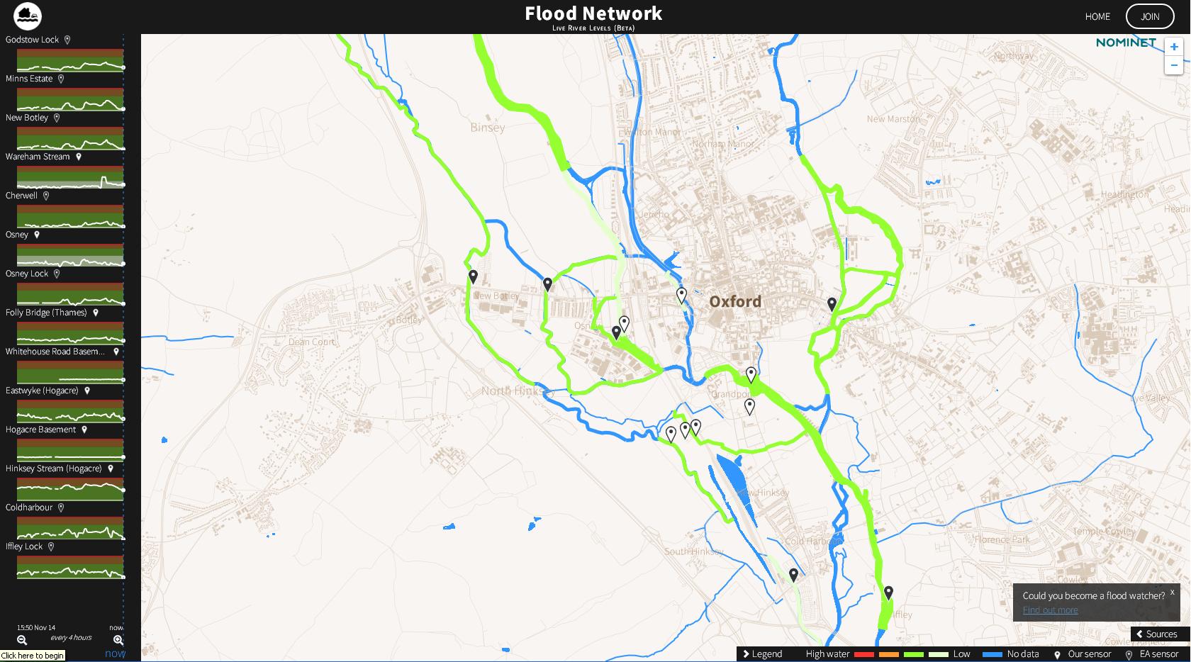
In the wake of Storm Desmond, believed to have caused up to £500 million in damages, IoT technology has been used to power an interactive flood map and sensor network in Oxford.
The system will help people in flood-hit areas to make better travel decisions as when a flood occurs by showing the water situation at street level.
The first application of its kind in the UK has seen over 30 IoT devices have been installed, including sensors to monitor water levels in the streams, groundwater and basin of the Thames and Cherwell river.
Developed by Nominet, in association with the Flood Network, the rollout has come after a pilot project with the Oxford Flood Network. The project focused on exploring the potential of the IoT to create an extensive, localised, early-warning system for flood-prone areas in the UK.
The Flood Network is powered by two pieces of technology. This includes a set of IoT tools to help innovators build and scale IoT applications in real environments.
The tools utilise existing internet standards, such as DNS, to provide proven scalable solutions with an existing support eco-system.
It also includes the use of TV white space to connect a number of hard-to-reach devices in the network.
Russell Haworth, CEO of Nominet said: "The IoT goes well beyond the home into a multitude of real-world, practical applications that can support infrastructure and environmental monitoring.
"If this can work in Oxford, it can work anywhere, and recent events have underlined the importance of effective monitoring systems when flood waters begin to rise."
The map can be viewed here